From climb to print: Alpe d'Huez, bend by bend
Some roads are famous enough to recognise from their outline alone. The climb to Alpe d'Huez is one: a short flat run out of Bourg-d'Oisans, then a stack of hairpins zigzagging up the mountainside. This is that road, traced from the valley to the top and turned into something you can hang. Scroll, and climb it with us.
The foot of the climb
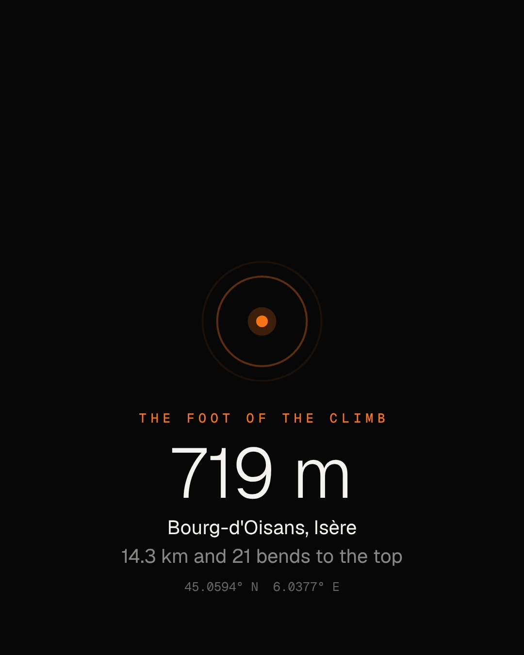
A roundabout in Bourg-d'Oisans, 719 m up. The road ahead is 14.3 km long and ends 1,140 m higher.
Scroll to start the climb
The road unfolds
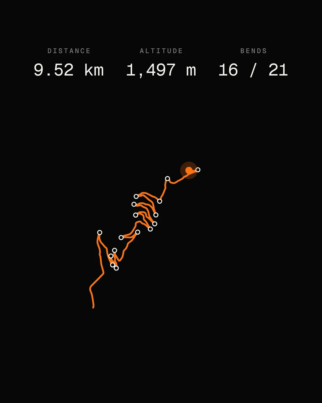
Flat for a moment, then the first hairpin at 1.5 km and 20 more after it. The line slows where the road steepens, the way your legs would.
The mountain
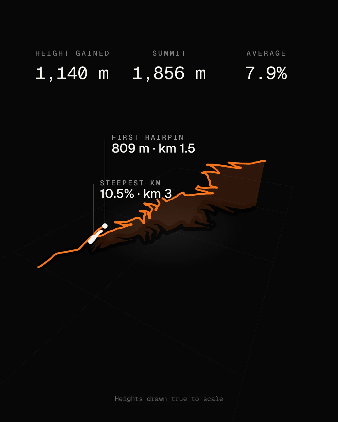
Tip the map and the road becomes a staircase. Nothing is stretched here: it gains 1,140 m at an average of 7.9%, with almost nowhere to rest.
The kilometres
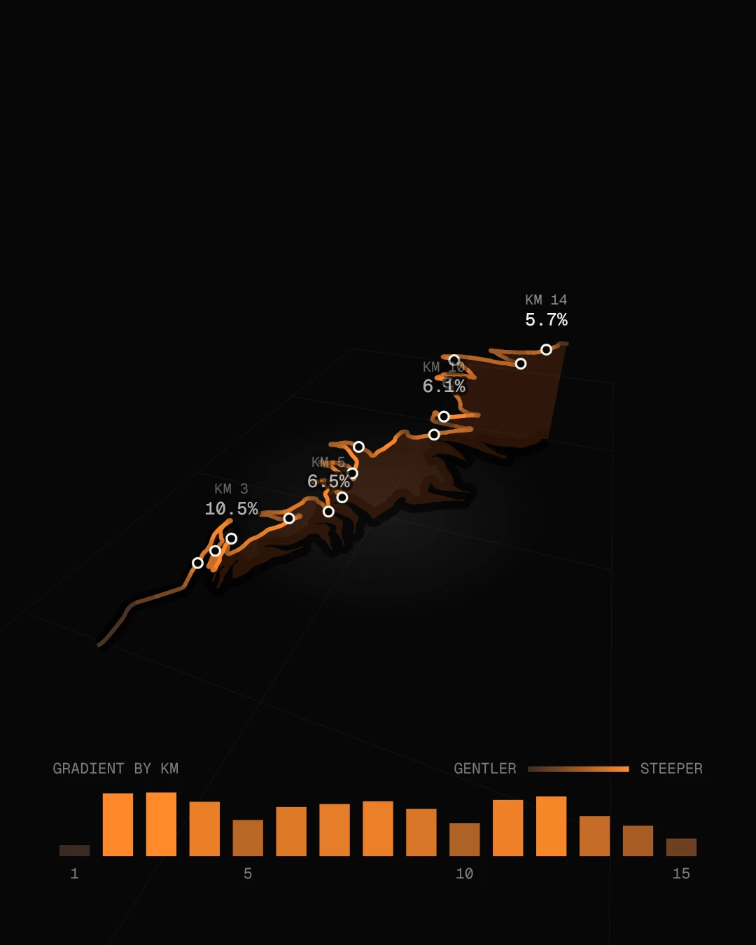
Every kilometre, graded. The brighter the orange, the steeper the road. The hardest part: kilometres 2 and 3 both top 10%.
Becoming a print
Then the numbers step back. What is left is the shape every cyclist knows on sight, a title, and the three figures that define a climb.
Yours next
Same road, three moods. Add your own ride and the time is yours to print too.
Your device asks for reduced motion, so this story is shown as still frames.
The foot of the climb
A roundabout in Bourg-d'Oisans, 719 m up. The road ahead is 14.3 km long and ends 1,140 m higher.
The road unfolds
Flat for a moment, then the first hairpin at 1.5 km and 20 more after it. The line slows where the road steepens, the way your legs would.
The mountain
Tip the map and the road becomes a staircase. Nothing is stretched here: it gains 1,140 m at an average of 7.9%, with almost nowhere to rest.
The kilometres
Every kilometre, graded. The brighter the orange, the steeper the road. The hardest part: kilometres 2 and 3 both top 10%.
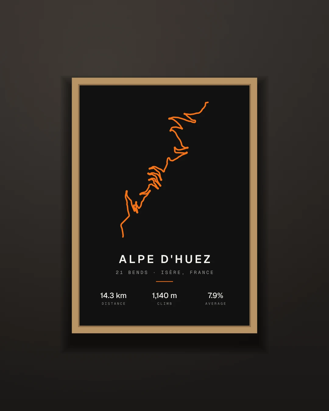
Becoming a print
Then the numbers step back. What is left is the shape every cyclist knows on sight, a title, and the three figures that define a climb.
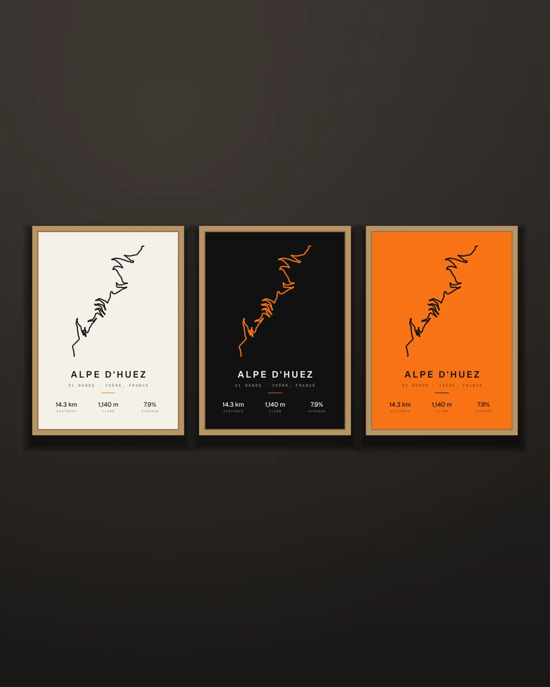
Yours next
Same road, three moods. Add your own ride and the time is yours to print too.
- Make yours
Why this road
The Tour de France first finished here in 1952, when Fausto Coppi won, and it has kept coming back. The bends are numbered on roadside signs, counting down from 21 at the bottom to 1 at the top, and each sign carries the names of riders who have won the stage. For anyone who rides, it is a pilgrimage: thousands go up it every summer, most of them a great deal slower than the names on the signs.
It is not the longest climb in the Alps, or the highest, or even the steepest. It is the one whose shape everybody knows.
What the road says
The numbers explain why it hurts. The first kilometre from the roundabout barely rises. Then the road tilts, and kilometres 2 and 3 both average more than 10%: the hardest part of the whole climb arrives before you have warmed up. The first hairpin comes at 1.5 km, already 90 m above the valley floor.
After that it settles into a rhythm of ramps and bends, mostly between 6% and 9%, with a second sting of nearly 10% around kilometres 11 and 12. From roundabout to summit the road gains 1,140 m and gives almost none of it back.
The tilted view in the story is drawn to true scale. Nothing is exaggerated, which is itself a little alarming.
From road to frame
The print at the end keeps three figures: 14.3 km, 1,140 m and 7.9%. Distance, height and average gradient are how cyclists describe any climb, so they are what goes under the line.
A route like this suits the plainest treatment. No map underneath, just the road: the hairpins do all the work. Dark paper or pale, a loud line or a quiet one, is up to you.
Your turn
The story uses the road itself, so it has no rider and no time. Yours will. If you have ridden it, or any climb you are proud of, export the GPX file from your bike computer or connect Strava and pick the ride. Your print gets your own line, your date and your time at the top.
And if the ride is still on the list, a print of the road is a decent way to keep it there.
How we measured it
No one's recorded ride was used. The line is the D211 as mapped by OpenStreetMap contributors, followed from the roundabout where it leaves the valley road in Bourg-d'Oisans to its high point in the resort, where Route du Signal meets Avenue du Rif Nel. Heights come from open terrain data (Mapzen Terrain Tiles), averaged over 300 m of road, because terrain models wobble by a few metres on a road cut into a slope.
You will often see the climb quoted as 13.8 km at 8.1%. That is measured from where the road first tilts. We started earlier, at the roundabout, which makes ours a little longer and a little gentler on average. We counted a hairpin wherever the road turns through more than 125 degrees within 80 m; that finds exactly 21 below the resort, and two more inside it that carry no number. Road data © OpenStreetMap contributors.